I was lucky enough to be a very early customer of Google Earth, when they first released it on the beta version. It was not so long ago, but those days (few months back) they didn't had a closer view of Sri Lanka or Colombo. All we could see was some cloud cover when we zoom into Colombo.
But, couple of months back they've updated Google Earth with some extreme close up satellite pictures of Sri Lanka. I could see my home in the out skirt of Colombo, and the yellow Latec busses are clearly visible all around Colombo streets.

Birds eye view of R Premadasa Stadium Keththarama
No argument is that, Google is becoming the big daddy of everything. Up to 80's it was IBM. Then, Bill Gates Microsoft took over. Now, is the era of big search giant. Before commenting on further about Google earth I would like to share with you 2 real life experiences I had with Google earth recently.
One of my friends invited me to a party at his home. He was in Hokandara. I asked him the directions to the house. He asked me "Do you have Google Earth on your PC?" I said "yes"
Then he logged on to Google Earth, and zoomed into Colombo. From there, he cleverly showed me the way to his home from my office with all the land marks on the way. I then studies the pictures for about 20 minutes, and painted a clear picture my self.
That evening I felt like driving home, when I effortlessly spotted my friends house!
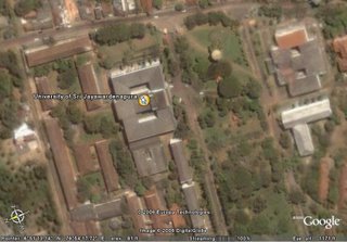
University of Sri Jayawardenepura Sumangala Building on Google Earth
One of my cousins is running an electronic items shop in Maradana. He called me and asked to meet him at his shop. After writing down the address and location, I searched Google Earth, to figure out the shortest and (most possibly) traffic free route to his shop from my office!
It's amazing how easy things are with these technology. Now, for people like me who don't like to advertise much, that you are not familiar with roads 7 streets in Colombo, Google Earth is the perfect solution!
Up to date they have covered vast area of Sri Lanka on Google including LTTE controlled areas. A friend showed me the Tiger airstrip in Vanni, spotted on Google Earth. And there are many "suspicious" white spots in the midst of ever green jungles of Vanni!!!!
Some people argue, this as a security threat. Just as we spot tiger air strips, they can spot all important locations in Colombo. But, did they used Google Earth in Central Bank bombing? BIA attack?
Being a very very optimistic character, I always look at the lighter side of it. Google Earth is here to ease our lives. Now, you can see a birds eye view of your neighborhood, and spot the easiest path to your friends house from your house. And, you can explore some other country's streets while sitting on your seat. I have viewed the so popular Area 51 site in USA on Google Earth!
Sirasa News first is using Google Earth, in their "Around the world in 99 seconds" news item. I've seen CNN using this to elaborate certain positions in Lebanon.
 I like to see 3d maps of sri lanka but No way to....