Most of you have heard of this Google street view & some may not. So this thread is for all of you.
What is Google street view?
Google Street View is a technology featured in Google Maps and Google Earth that provides panoramic views from various positions along many streets in the world. It was launched on May 25, 2007, originally only in several cities in the United States, and has since gradually expanded to include more cities and rural areas worldwide.

Google street view images appear after zooming in beyond the highest zooming level in maps and satellite images, and also by dragging a "pegman" icon onto a location on a map. Using the keyboard or mouse the horizontal and vertical viewing direction and the zoom level can be selected. A solid or broken line in the photo shows the approximate path followed by the camera car, and arrows link to the next photo in each direction. At junctions and crossings of camera car routes, more arrows are shown.
Where Google street view is available?
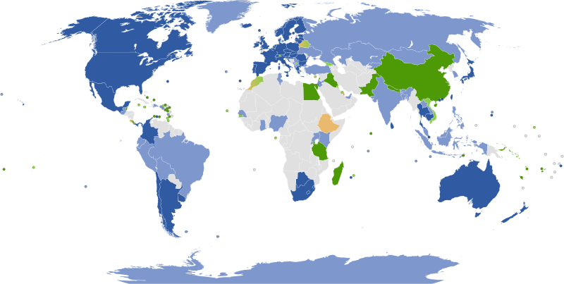
Google earth is presently available in the countries that have been highlighted in dark blue. And the countries that have been highlighted in light blue they are still planing to introduce the Google street view.
The cameras they used to develop the Google street view.
Google has used three types of car-mounted cameras in the past to take Street View photographs. Generations 1-3 were used to take photographs in the United States. The first generation was quickly superseded and images were replaced with images taken with 2nd and 3rd generation cameras. Second generation cameras were used to take photographs in Australia. The shadows caused by the 1st, 2nd and 4th generation cameras are occasionally viewable in images taken in mornings and evenings. The new 4th generation cameras will be used to completely replace all images taken with earlier generation cameras. 4th generation cameras take near-HD images and deliver much better quality than earlier cameras.
In October 2009, Google introduced the Street View Trike, a pedal tricycle with a 4th generation camera mounted to take images where cars cannot reach. All streetview images taken now will be taken with the 4th Generation streetview cameras.

In February 2010, Google introduced the Street View Snowmobile, a snowmobile with a 4th generation camera mounted to take images on the Whistler Blackcomb Ski Slopes in preparation for the winter olympics in Vancouver, Canada.
Google plans to re shoot areas with pre-4th generation cameras with 4th generation cameras.

Google's first street view van camera

Google's second street view camera

Google's third streetview camera, similar to the second but with 3D mapping

Google's latest camera, which takes near HD imagery as well as 3D mapping.
How to use Google street view?
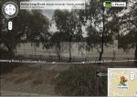
By using the Google street view you can virtually visit that place.
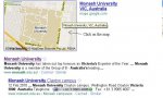
For example we shall visit the world famous Monash University in Australaia.
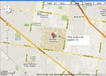
You just follow up the below tutorial.


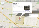
At finally you can experience the Google Street.
For example we shall visit the world famous Monash University in Australaia.
You just follow up the below tutorial.
At finally you can experience the Google Street.
Hope you all like this thread, Comments & REP+ are welcome.
Attachments

Last edited:

")

 habai ithin lankawe ewaa nam ne.. nikan pics witharai...