Australia flooding
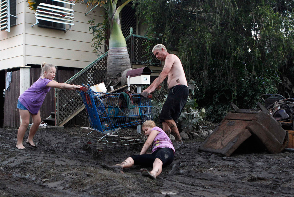
Seasonal flooding across eastern Australia has been widespread and devastating this spring - their wettest on record. Cyclone Tasha came along two weeks ago, and dumped even more water on Queensland. Hundreds of thousands of people in an area the size of France and Germany combined are now affected, and at least nine people have been killed so far. Authorities are working to evacuate some communities and airlift supplies to others as the water level is expected to continue rising over the next two days and 38 regions were declared natural disaster areas.
++ add rep if you like the post
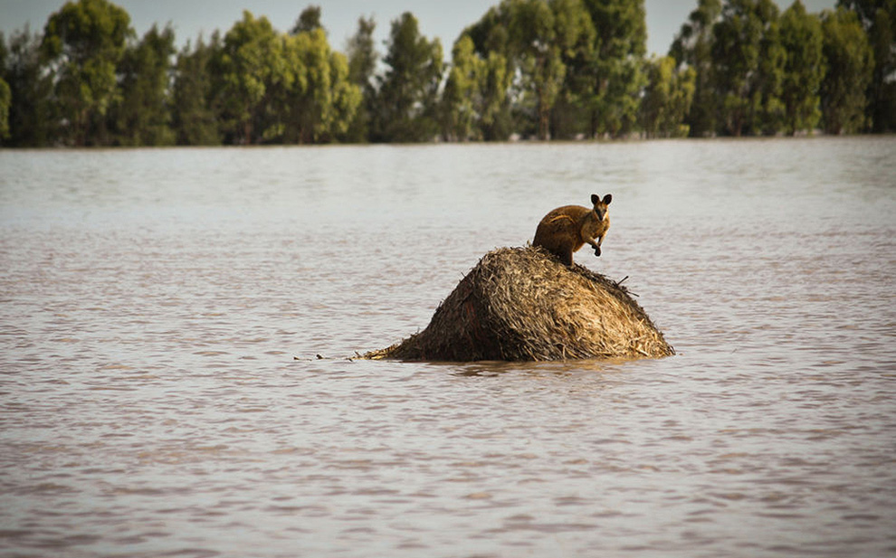
A wallaby stands on a large round hay bale, trapped by rising flood waters outside the town of Dalby in Queensland, Australia on Thursday, Dec. 30, 2010. Days of torrential downpours have left parts of central and southern Queensland state inundated, flooding thousands of homes and businesses, cutting off roads and forcing the entire populations of two towns to evacuate.
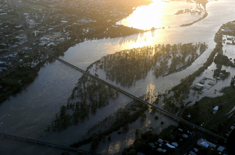
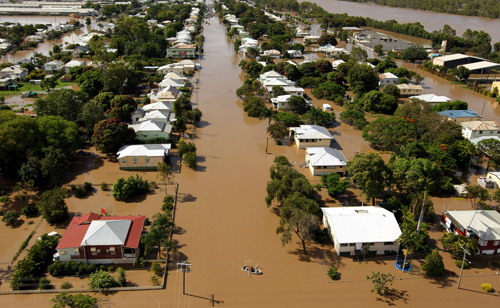
The swollen Burnett River cuts the sugar cane town of Bundaberg in two and submerges Harriett Island on December 30, 2010 after entire towns in Queensland state were inundated by the worst deluges in decades.
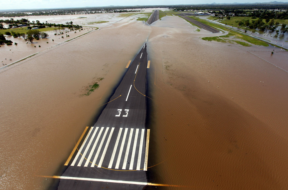
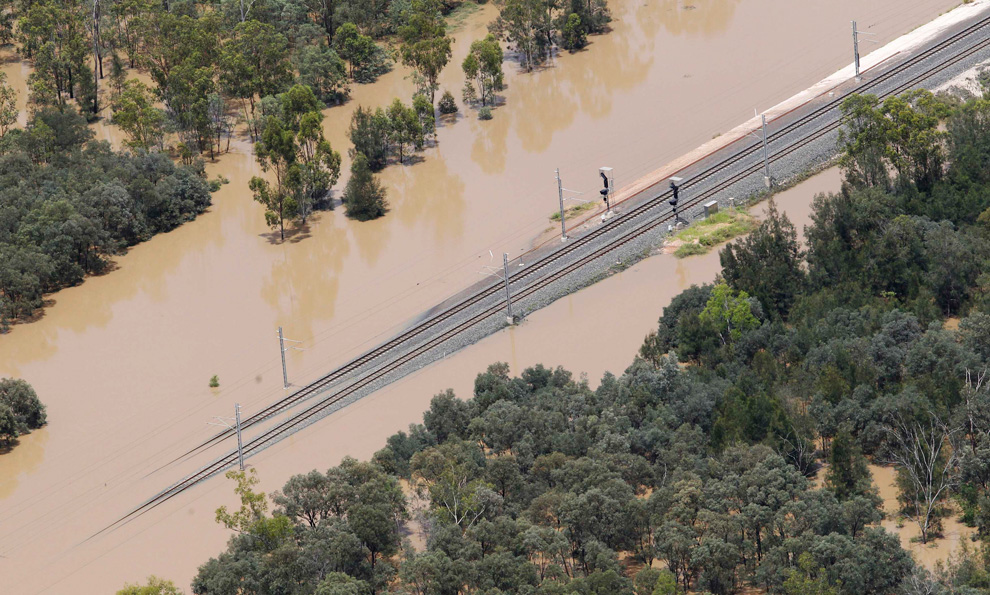
Rising floodwaters spread across the runway of the airport at Rockhampton, in eastern Queensland, Australia on January 2, 2011.

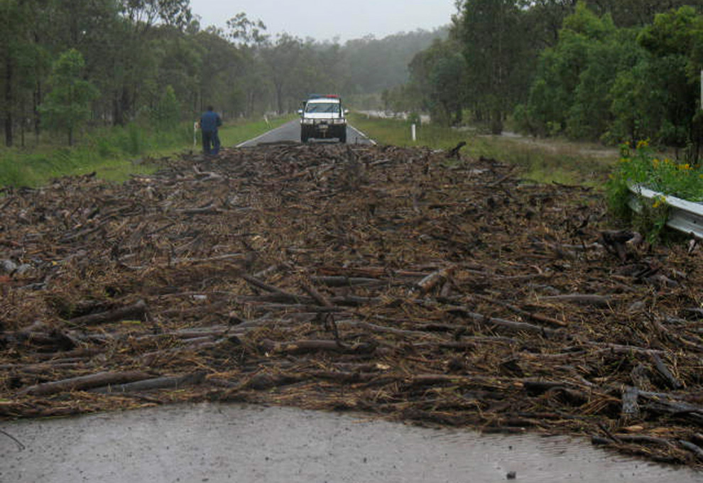
A snake crosses the Capricorn Highway which is under floodwaters 6km south of Rockhampton, Australia on January 3, 2011.
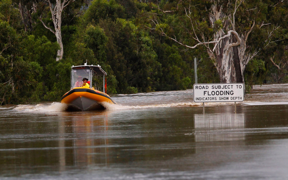
An emergency personnel boat motors past a street sign partially covered by floodwaters 6km south of Rockhampton on January 3, 2011.

Houses in the town of Theodore, about 410km (255 miles) north west of Brisbane, Australia, are partially submerged by flood waters in this January 1, 2011 picture.

Cattle walk through flooded crops near the town of Theodore in Australia's state of Queensland January 2, 2011. Large parts of Australia's coastal northeast were flooded on Sunday in a spreading environmental disaster as thousands of residents fled their homes to avoid the runoff from a Christmas deluge.

A main street in the flooded town of Theodore, Australia is used as a helicopter landing zone as residents are evacuated in this January 1, 2011 picture.
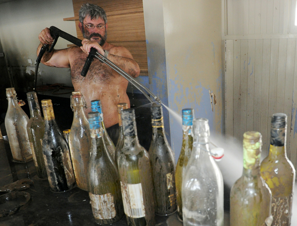
Bruce Dalton cleans mud from the recently submerged Spinnakers bar and restaurant on the banks of the swollen Burnett River in Bundaberg as flood waters begin to recede on January 1, 2011.
Rising floodwaters spread through the low-lying suburb of Depot Hill in Rockhampton, in eastern Queensland on January 2, 2011.
Seasonal flooding across eastern Australia has been widespread and devastating this spring - their wettest on record. Cyclone Tasha came along two weeks ago, and dumped even more water on Queensland. Hundreds of thousands of people in an area the size of France and Germany combined are now affected, and at least nine people have been killed so far. Authorities are working to evacuate some communities and airlift supplies to others as the water level is expected to continue rising over the next two days and 38 regions were declared natural disaster areas.
++ add rep if you like the post

A wallaby stands on a large round hay bale, trapped by rising flood waters outside the town of Dalby in Queensland, Australia on Thursday, Dec. 30, 2010. Days of torrential downpours have left parts of central and southern Queensland state inundated, flooding thousands of homes and businesses, cutting off roads and forcing the entire populations of two towns to evacuate.

The swollen Burnett River cuts the sugar cane town of Bundaberg in two and submerges Harriett Island on December 30, 2010 after entire towns in Queensland state were inundated by the worst deluges in decades.

Rising floodwaters spread across the runway of the airport at Rockhampton, in eastern Queensland, Australia on January 2, 2011.

A snake crosses the Capricorn Highway which is under floodwaters 6km south of Rockhampton, Australia on January 3, 2011.

An emergency personnel boat motors past a street sign partially covered by floodwaters 6km south of Rockhampton on January 3, 2011.

Houses in the town of Theodore, about 410km (255 miles) north west of Brisbane, Australia, are partially submerged by flood waters in this January 1, 2011 picture.

Cattle walk through flooded crops near the town of Theodore in Australia's state of Queensland January 2, 2011. Large parts of Australia's coastal northeast were flooded on Sunday in a spreading environmental disaster as thousands of residents fled their homes to avoid the runoff from a Christmas deluge.

A main street in the flooded town of Theodore, Australia is used as a helicopter landing zone as residents are evacuated in this January 1, 2011 picture.

Bruce Dalton cleans mud from the recently submerged Spinnakers bar and restaurant on the banks of the swollen Burnett River in Bundaberg as flood waters begin to recede on January 1, 2011.

Rising floodwaters spread through the low-lying suburb of Depot Hill in Rockhampton, in eastern Queensland on January 2, 2011.


")